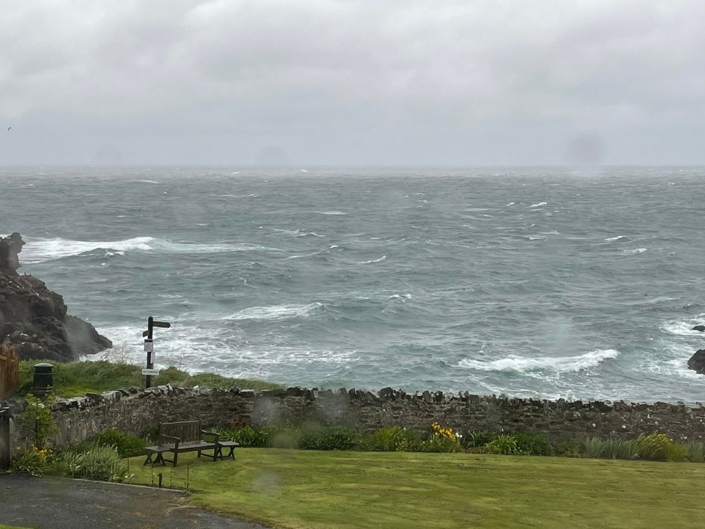
It’s 2021, lockdown is easing and the team were on the road earlier than usual kicking off the fieldwork season with the first baseline survey of the underwater world of St Abbs, Scotland, and the surrounding Berwickshire area. We arrived during the May Bank Holiday with the promise of good weather, however, 3 metre swells had other ideas. After a couple of days we eventually got the green light for fieldwork.
In partnership with the Blue Marine Foundation (BLUE), the coastal waters around the centred Berwickshire Marine Reserve (BMR) have been identified as a site of both ecological and social importance.
Designated in 1984, the BMR is the only voluntary marine reserve in Scotland and the second oldest marine reserve in the UK. It extends along 9 km2 of the Berwickshire coastline in southeast Scotland, between Thrummie Carr in the north to Hairy Ness in the south and covers an area of 1,030 hectares. Through community-led management it has aimed to protect the rich marine biodiversity found as a result of converging northern and southern currents. This includes soft corals, sea caves, rocky reefs and kelp forests that provide an important fishing ground to the local creel fleet targeting crab and lobster. The BMR is widely regarded as one of the top dive sites in the UK.
The BMR itself sits within a multitude of Marine Protected Areas (MPAs) which recognise its national and international importance, including the Berwickshire and North Northumberland marine Special Area of Conservation (SAC) and a Static Gear Reserve bans the use of any mobile gear in an area which encompasses the majority of the BMR (see below).
Its long history and has fostered a strong community voice for improved marine management. However, in recent years, gaps in data persist for many marine habitats, fisheries and stakeholders, like for many MPAs around Scotland. The presence and extent of important habitats and species and the pressures, such as fishing, are not understood. BLUE aims to work with the community of Berwickshire to create a template for well protected and sustainably managed MPAs in Scotland. This will include a number of research projects to address data deficiencies to further the understanding of the habitats and important species in Berwickshire, its commercial and recreational fishing pressures and to strengthen the management of the MPA moving forward.
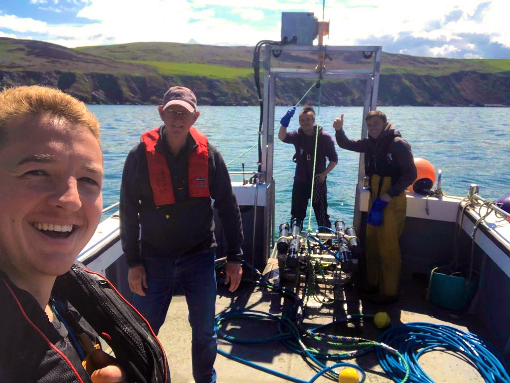
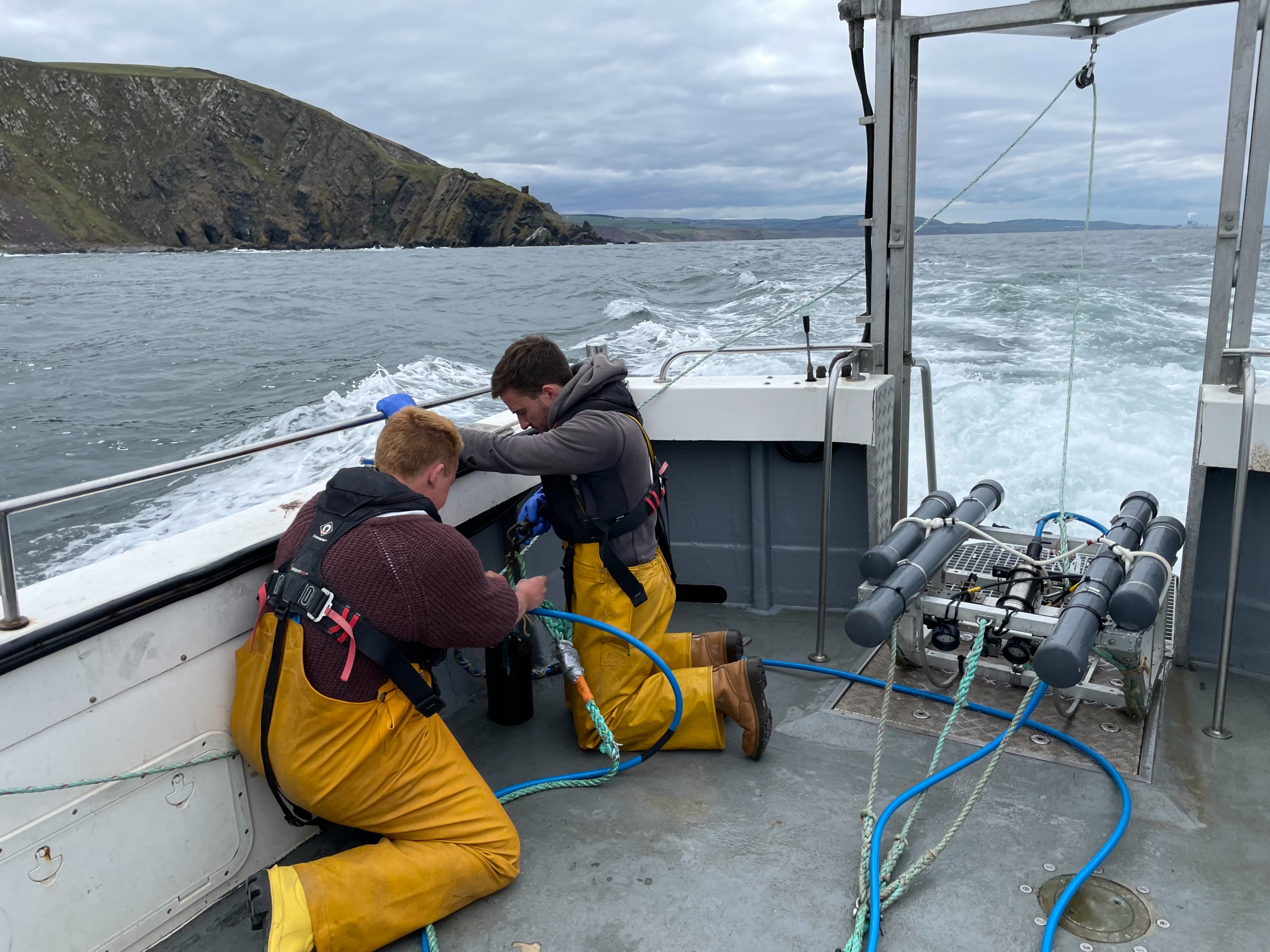
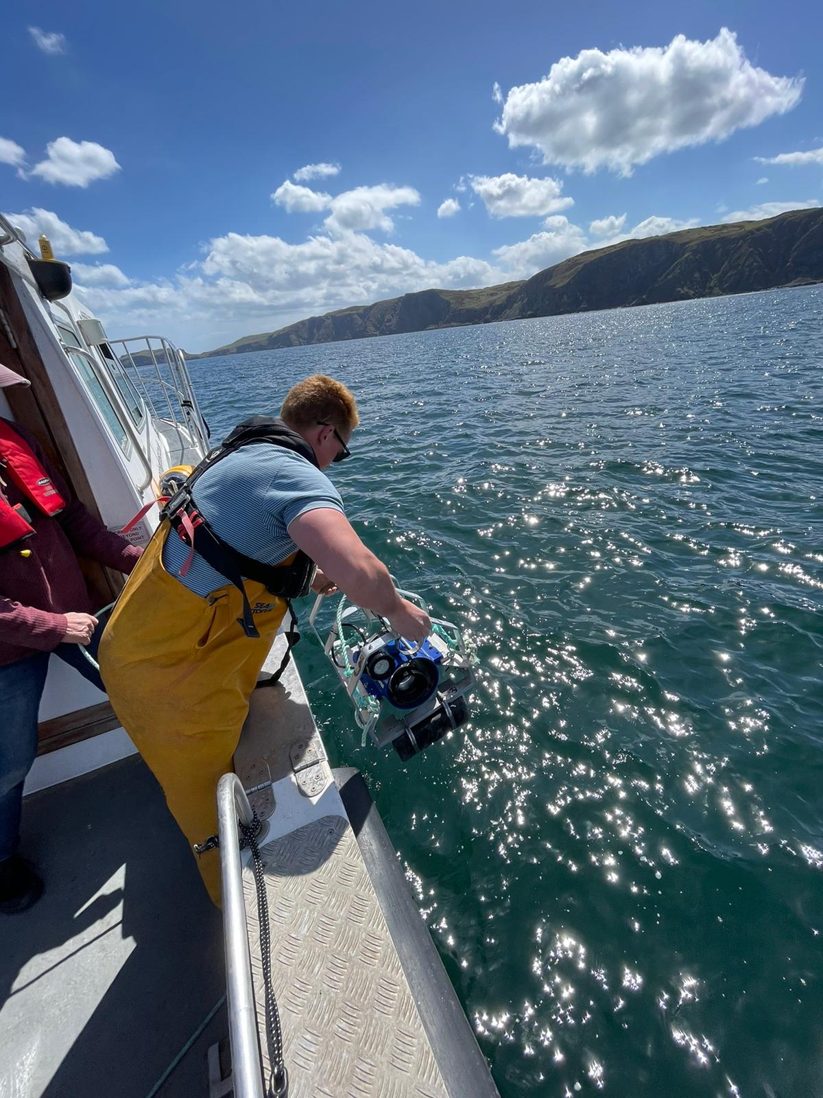
Prior to our arrival, St Andrews University carried out acoustic surveys to gather high-resolution bathymetric data and map the coarse habitats present along areas of interest. Using this data we carried out a survey that looked at the important rocky reef habitats within the various designations, providing a benthic ecological baseline of these habitats. We deployed our trusty towed video and baited remote underwater video systems (BRUVs) to look at the sessile and mobile reef associated communities at around 50 sites spread throughout the Berwickshire area.
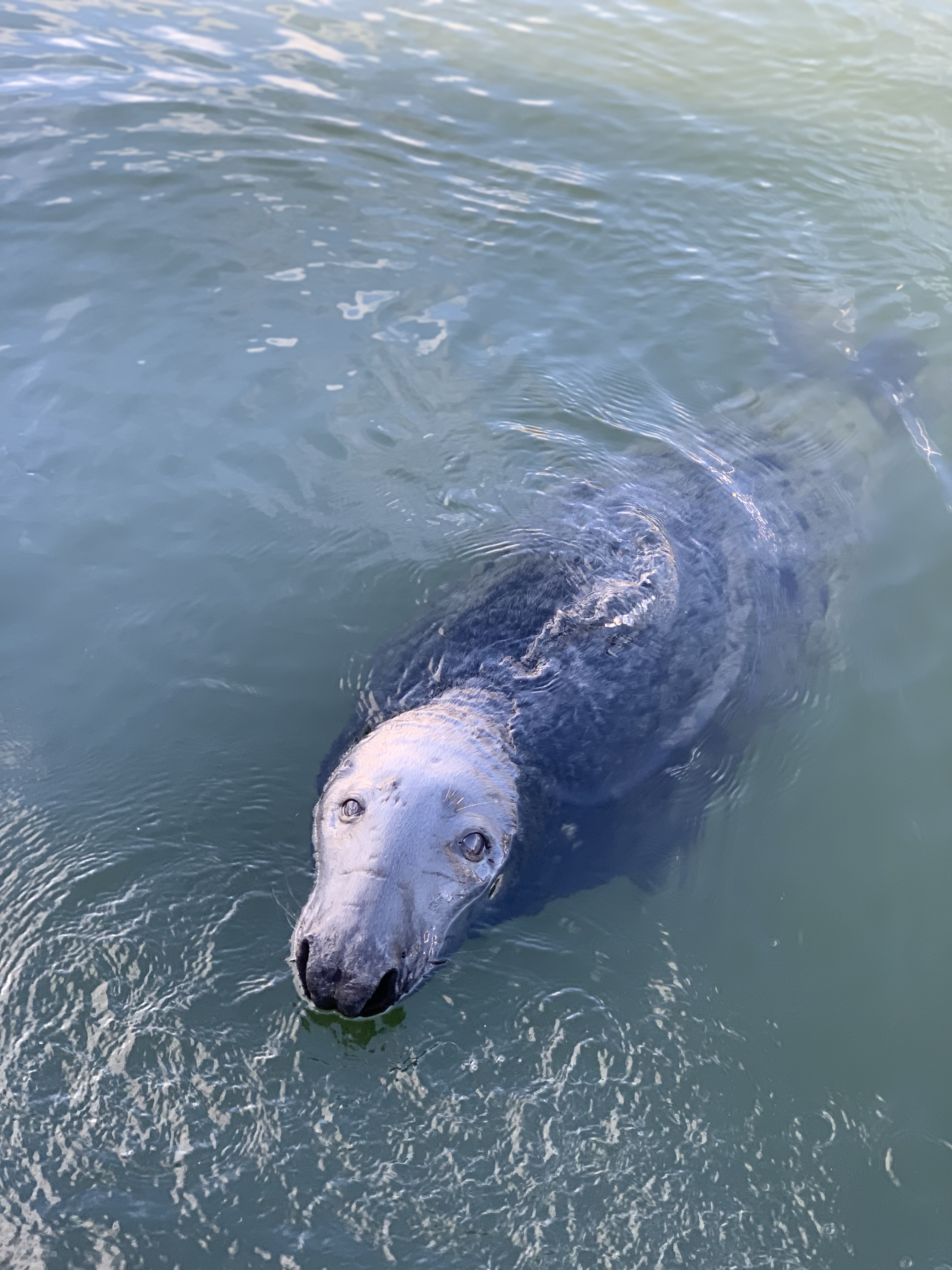
We certainly found some significant rocky reef! Areas comprising of larger boulder fields, rocky ledges and cobbly plains covered in Dead Man’s Fingers, edible sea urchins, sunstars, squat lobsters, velvet swimming crabs, lobsters and more. We saw these amazing habitats at 15 metres all the way down to almost 60 metres! We were regularly accompanied by an audience of diving gannets, razorbills inquisitive seals and porpoises.
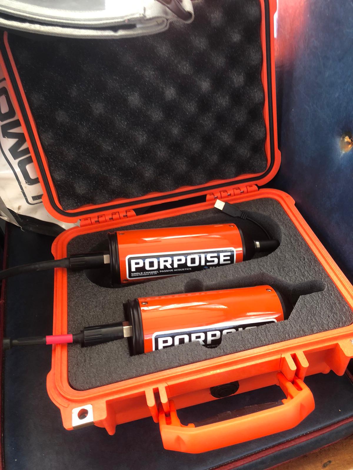
Following on from work in Lyme Bay (Davies et al. 2020), we sent down hydrophones (underwater microphones) to assess how different levels of protection may influence the abundance of noise. Unlike a large proportion of research of underwater sound, we avoid listening to individual specific species, such as whales or dolphins, but try to understand the abundance, complexity and volume of noises produced by the whole benthic ecosystem. This work will allow us to compare the underwater noise to the abundance of species we are recording on the towed and baited video. Yet, as we are deploying these hydrophones for over 24 hours we are hoping to also describe daily patterns, such as dawn and dusk choruses.
By combining all this data, on top of the existing habitat information, it is hoped a comprehensive ecological baseline for the area can be established and form the start of a long-term monitoring site which can inform future management of the area.
With the trusty support of Silver Sky, a local dive boat, the knowledgeable local skipper Jim and a good dose of game-changing orange sponge (thanks to Jim’s wife) we managed to brave the swells of the North Sea and we can’t wait to come back. Now time for some analysis!