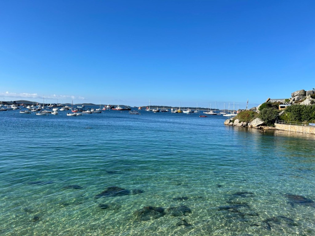
How can we measure the impact of mobile fishing practices on marine habitats? The rich marine ecosystems that surround the Isles of Scilly, an archipelago off the coast of Cornwall (southwest England), have been subject to limited bottom-towed trawling over the past decade. This has provided a rare opportunity to assess the impact of mobile fishing practices on sediment habitats as trawling begins again.
Assessing the Impact of Bottom-Towed Fishing on Sediment Habitats
Over the past decade, mobile fishing activity in the waters surrounding the Isles of Scilly has been minimal, largely due to perceptions of low economic value and more accessible fishing grounds elsewhere. However, a renewed interest from a small number of fishing vessels has presented a rare opportunity to carry out a ‘Before, After, Control, and Impact’ (BACI) study on mobile fishing in the region. Such studies are uncommon, as they typically rely on spatial comparisons between fished and unfished areas, which are often affected by other environmental factors. In contrast, the historically low fishing pressure in the Isles of Scilly, coupled with the anticipated return of trawling, offers the UK’s first chance to observe and measure ecosystem changes resulting directly from trawling activity.
The Applied Marine Ecosystems Research Unit is evaluating the effects of mobile fishing gear on offshore sediment habitats, using pre-disturbance data as a baseline. The research also aims to assess blue carbon levels using advanced technologies, and to collect long-term data on changes to infaunal, benthic, and mobile species populations. This will provide valuable insights into the recovery trajectories of sediment habitats following disturbance.
In summer 2023, the University of Plymouth, in collaboration with the Isles of Scilly IFCA and Cornwall IFCA, returned to the region to carry out baseline surveys. Data were collected from sites that have remained untrawled since 2010, using non-invasive methods such as baited remote underwater video and towed underwater video to assess habitats and biodiversity at depths greater than 90 meters. These surveys establish a reference point for evaluating future ecological changes once trawling resumes.
In 2024, the monitoring of these habitats continued, with baited remote underwater video (BRUV) and towed underwater video (TUV) surveys taking place in May and September and a GRAB sampling survey taking place in November. Furthermore, the University of Plymouth has started a PhD project in 2024 focussing on ocean sediments surrounding the Isles of Scilly. The project aims to quantify the impact of bottom-towed fishing on benthic ecosystems and subtidal sediment habitats which have not been trawled or dredged in over 10 years. The Isles of Scilly provides a unique opportunity to study changes in the benthic ecology of relatively untrawled sediment habitats, following updated management measures and renewed interest from trawlers to return to the area.

This initiative marks the first time in the UK that the impact of bottom-towed fishing on sediment habitats will be studied using a pre-disturbance control, establishing a crucial evidence base for marine management and conservation.
Background to the New Byelaw and Trawling Activity in the Isles of Scilly
The Isles of Scilly, located off the coast of Cornwall, form a unique archipelago known for its diverse marine habitats and rich biodiversity. These waters support small-scale fisheries, a vibrant marine recreation sector, and play a central role in the region’s tourism economy. Key habitats such as extensive seagrass beds, rocky reefs, sandbanks, and mudflats provide vital ecosystem services and support numerous ecologically and economically important species throughout their life cycles.

The management of these habitats has required an adaptive, evidence-based approach, evolving alongside improved scientific understanding and shifting patterns of marine resource use. The archipelago benefits from a suite of conservation designations, including the Isles of Scilly Special Area of Conservation (SAC), Marine Conservation Zone (MCZ), and Special Protection Area (SPA), which collectively aim to protect its exceptional marine environment.
A central challenge in marine management across the UK and globally is the lack of relatively undisturbed reference habitats, due to widespread historic and ongoing marine exploitation. Such areas are essential for assessing the ecological impacts of human activities and evaluating the effectiveness of conservation strategies. Without these baselines, management efforts risk being constrained by “shifting baselines”—where degraded conditions become accepted as the norm. The Isles of Scilly, with their geographical isolation and low population density, offer one of the few remaining examples of comparatively low-impact marine environments in the UK.
Building on this context, the University of Plymouth previously led the Site Classification to Inform Sustainable Lives and Livelihoods for Fisheries and Ecosystems (SCILL-E) project. This initiative surveyed both nearshore and offshore habitats around the Isles, employing a range of advanced marine sampling techniques—including side-scan sonar, towed underwater video (TUV), baited remote underwater video (BRUV), and grab sampling. These methods allowed researchers to develop a comprehensive understanding of the area’s marine biodiversity and habitat types. Among the critical habitats identified were sediment veneers—areas where reef-forming species emerge through a thin layer of sediment, indicating the presence of underlying bedrock and offering key ecological functions.
This growing body of knowledge has informed the development of a new byelaw regulating bottom-towed fishing activity in the region, ensuring that management decisions are rooted in science and geared towards long-term ecological sustainability.
Timeline of activity
2013 – In response to the ‘Revised Approach’ the Isles of Scilly Inshore Fisheries and Conservation Authority (IFCA) passed a new byelaw to limit mobile gear activity within the Isles of Scilly district and Special Area of Conservation (Map 1).
2018 – The Isles of Scilly IFCA recognise the need for a review of this byelaw to provide greater strength and flexibility and commission the University of Plymouth to undertake surveys and an ecosystem service asset and risk assessment to help guide and inform decision making. The surveys identified some previously unknown deep reef veneer habitats to the east of the islands which were an important driver for increasing the extent of the no-trawl zone.
2023 – A new Byelaw is pending approval within the Isles of Scilly district, defining a large no-trawl zone of 398km2 encompassing all currently designated sites and prohibiting trawling in 43% of the district.
May 2023 – Baited Remote Underwater Video (BRUV) and Towed Underwater Video (TUV) surveys carried out by the University of Plymouth for the baseline of the BACI study. This is using a survey design to understand changes in the ecology of subtidal sediment habitats following the resumption of permitted bottom-towed fishing in the restricted area, compared to within the new no-trawl byelaw area.
May to November 2024 – Two more BRUV and TUV surveys completed in May and September, and GRAB sampling attempted in November. Together, the 2023 and 2024 datasets form the baseline of the BACI study.
December 2024 – the new no-trawl byelaw was approved by DEFRA and came into effect on 8th January 2025 Byelaws : Isles of Scilly IFCA.

